After Fort William and the Ben Nevis, our tour of the West Highlands continued with a 2-night stop in Ballachulish, a good place to explore the nearby valleys of the Glen Coe area.
Following the recommendation of our host the night before, Agnes dropped me just after the pass of Glencoe so I could run along the Lairing Gartain toward Dalness while she would take the next road along the River/Glen Etive. The beginning of the trail was very nice, but easy rarely lasts for long on trails in Scotland!


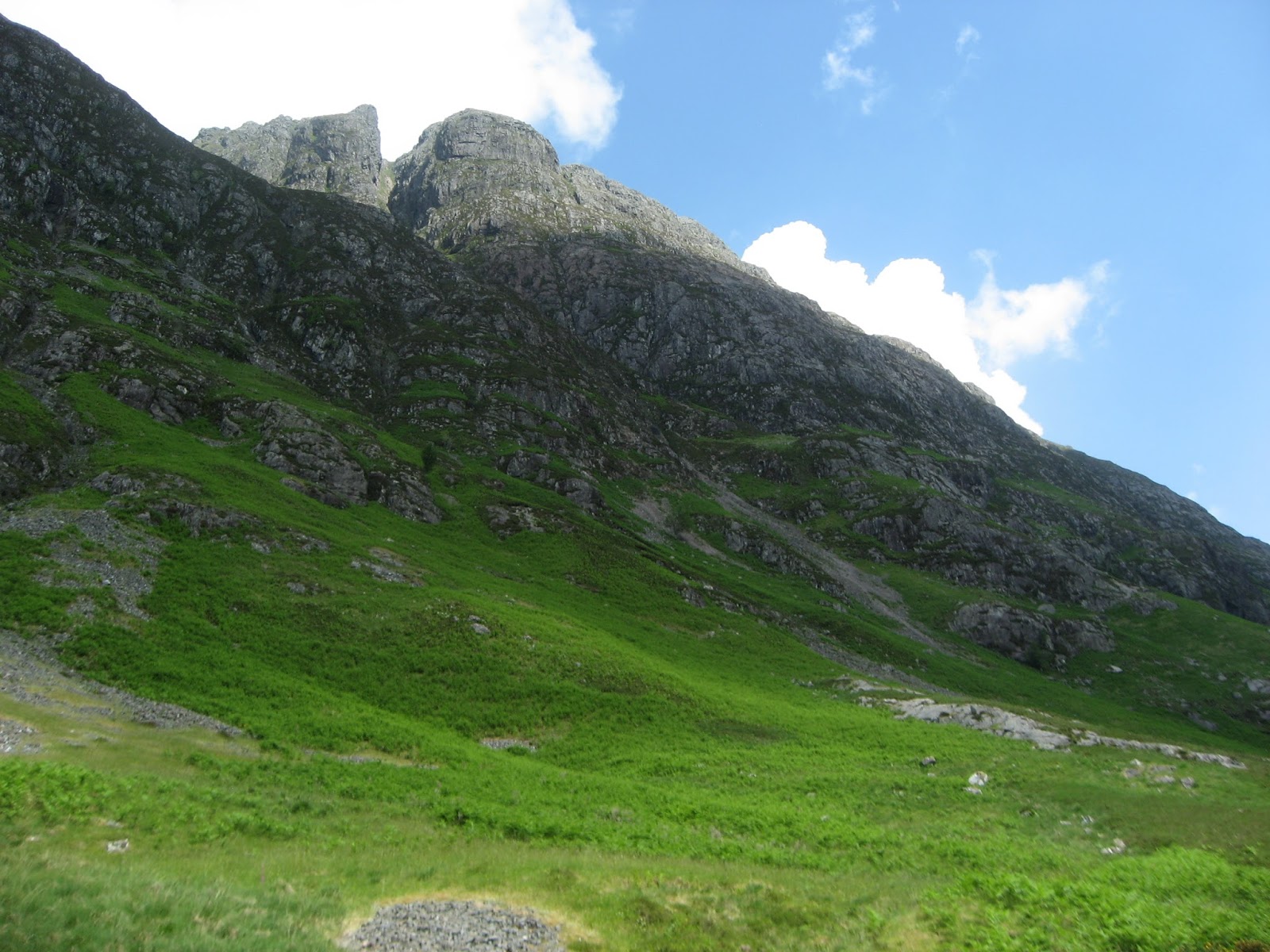
The trail was only 5 miles so I took a detour to climb along the torrent coming down from the high ridge called Buachaille Etive Mor.


Once I got to the ridge, I veered to the right to climb the closest peak, the Stob Coire Atrium (941 m, 3,087 ft). Not much higher than the 2,800 feet of Black Mountain in my Cupertino backyard, except that the trail was less than a mile and it took me about an hour each way, that killed my average pace, I don't recall ever moving that slow, at 23 min/mile... Short of time, I missed the opportunity to climb another 1,000-meter summit. I was quite close to the top of the Stob na Doire (1,011 m) but that seemed like another 30 minutes with all these lose rocks.


Did you know that there are 282 of these summits over 3,000 feet in Scotland and they are named munros after Sir Hugh Munro? And a challenge is to climb all of them of course: the Munro bagging!
With this climb I'm done with two (Ben Nevis on Tuesday), better not aiming at this challenge or I'll regret to have missed that other reachable one as number 3!
With this climb I'm done with two (Ben Nevis on Tuesday), better not aiming at this challenge or I'll regret to have missed that other reachable one as number 3!

Here is a nice detailed view provided by the Hill Bagging web site which lists more than 19,000 hills in Great Britain!

The rest of the trail down to Dalness was also very narrow, technical and slippery, so much that it took me about 2 hours to cover 10 kilometers, making Agnès wait much more than she wanted...


In contrast, I covered the next 7 miles on the uphill road in 44 minutes! This road is one single lane but the traffic was quite reasonable, even in this second week of June. It offers amazing views of the Glen Etive valley and a few opportunities to cool down in the river which has a few falls and pools (opportunities to stop on the side of the road may be sparser in the high season of July and August). Here is my Strava activity in case you are looking for a run in the Glencoe area.
That made for a good tour of what is called the Royal Forest on detailed maps although, like many other places, the forest must have been heavily harvested because that didn't look much like a forest to me. For one thing, trees don't grow over about 500 meters, so all the peaks are just covered with grass. And rocks too, a lot actually.
And to illustrate how the weather can quickly evolve, here is a view of Stob Dearh hill (1,022 m) on Thursday afternoon (the first hill of that National Forest range).
 And the next day, from the same spot.
 Not quite the same shape and view of that mountain, nor the same climbing conditions!
Indeed, after a week of sunshine, we finally got some good rain on Friday while driving to Loch Lomond, a much more typical Scottish weather!
And to illustrate how the weather can quickly evolve, here is a view of Stob Dearh hill (1,022 m) on Thursday afternoon (the first hill of that National Forest range).


Indeed, after a week of sunshine, we finally got some good rain on Friday while driving to Loch Lomond, a much more typical Scottish weather!


.jpg )


No comments:
Post a Comment