Showing posts with label Running in Latin America. Show all posts

Friday, April 6, 2018

Running on Roatan, Honduras: a West End story

No, not a West Side story, I didn’t get caught into a rivalry between two local gangs, fortunately! With the bad reputation of this country in terms of security and political instability, that would have not turned into a good musical… Thankfully, we stayed on the Roatan island, home of 80,000 Hondurans, such an amazing melting pot of ethnicity, with inhabitants who came over the past 5 centuries from Europe, Africa, Asia and the Americas. A rich maritime history with quite some troubled times between the pirates who inhabited the many coves and the colonial navies conquering the American continent. Nowadays, though, it’s all about eco tourism leveraging the rain forest and its canopy and the corral reef accessible right off the beach. All while trying hard to preserve these natural and fragile wonders with 3 cruise ships stopping by 3 days a week...


On such a peaceful Caribbean 26-mile long island, I was hoping to get some good running now that my back is back on track. As soon as I asked for directions though, I was first told not to venture alone in the jungle for the risk for bad encounter with not only humans but also snakes. And that might have been a moot point since I didn’t see any trail around; another opportunity to remind how blessed some of us are to live in areas rich of pristine single trails. The second advice was to stay on roads then, although, with no driving licenses, car insurance, aging vehicles, narrow and windy lanes, it came with its own danger too. Indeed, the biggest danger came from the white taxis which seemed to purposely have fun pushing you out of the road, not really enjoyable. But, again, no other options as the beaches weren’t long enough to run either.
Actually, the best tip to run on the island is to get up at dawn and beat the traffic early in the morning. You certainly don’t want to be on these roads at night anyway. From 6 am, that leaves you an hour or two before the traffic and the temperature heat up.

Note that the West side of the island is much more touristic and accessible than the east side where the only paved road is so damaged that even SUVs pass potholes at under 5 mph.

On the West side, special mention for a 2-mile section of a road with sidewalk, feel free to go back and forth because I believe that’s the only flat sidewalk in the entire island, a real treat!

8 miles on Sunday, 12.5 on Monday, 14 on Tuesday and 17 on Wednesday, I started recognizing faces on the side of the road and knowing every turn and pothole on the road!
On Thursday, and from the second place we stayed at on Sandy Beach, I actually ventured on a dirt road, along the North shore, toward the East. Way less traffic there but some serious ups to the ridge of the island (~400-600 feet) and downs, unless you try to cut along the beaches.
I actually took Thursday off as we toured the island on a motorcycle, and Friday to fly back home. We were supposed to land at SFO by 9 pm then drive to Folsom for American River 50 this Saturday. The weather is so bad in SF that all flights are delayed so not sure if I’ll have a real night before the start… Or even make it to the start at all, a bummer! What a way to leave the stress-free Caribbean life; welcome back to planet Earth, ouch!

Meanwhile, here are a few pictures from this West End loop.

The beach of West End, paradise-style!
As you leave West End: palm trees can get you some solid and natural road side poles!
 The Carambola gardens:
 Better keep your finger crossed in this rural hospital...
 The intersection for the dirt road going for a few miles along the coast (my Wednesday run):
A boutique in Coxen Hole:
Coxen Hole cemetery:
The water zip line near one of the cruise ship docks (Norwegian):
The nice 3-mile long side walk along the South shore:
Fresh fruits on the go!
And gas truck going door to door too.
The end of the South section of the loop:
At the top of the hill, on the way back to West End, where you turn left onto a serious roller-coaster
 A lighthouse over West Bay (great views but doesn't look like it's operational).
And, to finish this series, a picture of a large cordage they use as speed bump. Well, in case you doubt, it really works, it slows down cars, trucks, buses, motorcycles to almost a halt. As for pedestrians: yikes, I must have been distracted by the views, or the shadow, but this 1-inch thing tripped me on my Monday run and I made a pretty hard face plant plus rolling over on my side, worth 6 bloody bruises (each hand, left hip, left shoulder, left knee, left ankle)! Will I really make it through this year, I start wondering... ;-) Nothing broken at least but it made snorkeling more interesting as the salty water reopened the wounds every day. Oh well, just some skin and a bit of flesh, it's already getting better after a few days.
Overall, I highly recommend this destination for authentic ecotourism and a great variety of activities on land or at sea. Definitely if you are into diving, but even if you are not, there is something for every style, from a few bigger and luxurious resorts on West Bay, to very remote and more rudimentary places on the East side. Contact me if you have any questions!
-->

Sunday, March 17, 2013

Running in Mexico City: Chapultepec and Paseo de la Reforma

I already wrote about running in Mexico City and Chapultepec in particular when I first visited this huge and vibrant city for the first time in August 2012.

However, this time, I had my camera so let me offer a visual tour of this nice neighborhood including the most opulent Polanco with the most expensive avenue in Latin America: Presidente Masaryk.

I flew right after my great Way Too Cool 50K race on Saturday evening and landed shortly after 4am. I slept a few hours upon getting to my room to complement the short 4-hour red-eye. I was then up for a recovery run which I intended to do on the 3K-loop in the park of Chapultepec (see one of the many distance markers, in meters).
However, on a Sunday and in a city of 22 million people, that was not counting on the herd of locals who converged to this particular place to enjoy the warm and sunny afternoon.
There was also a green/sustainable development fair on the 3K-loop course and the crowd made running impossible. On the other side of the park, people were lining up to drop their recycling at stations and get points.
I just completed one loop and decided to venture in the city without a map.
First, I ran on the Paseo de la Reforma along the park. Between two sets of busy car traffic lanes, this is an interesting dirt (quite dusty actually) trail, a straight 1.6 miles. If you stay at one of the nearby hotels on Campos Eliseos (not as large and fancy as the Parisian Champs Elysées!), and the Chapultepec is closed (it opens at 5am I believe but in case you are jet lagged and want to run at night), this may be an alternative good place to log a few miles.
I don't know for how long the exhibit will remain, there is a great collection of bronze sculptures from Jorge Marin currently on display on this Paseo de la Reforma section (plus a more eclectic collection of modern art sculptures on a bell theme).
After passing the impressive and majestic Auditorio Nacional, I explored the wealthy Polanco neighborhood, home of several international communities including the French one, and a display of quite a few of the most luxurious brands (fashion, watches, cars, ...).
With 17 client and business partner meetings over 5 days and two cities (Mexico City and Monterrey), I could only run twice, early in the morning: a half marathon on Wednesday morning (7 laps in Chapultapec) at 6:54 min/mile and 15 kilometers on Thursday. Not much mileage but a good altitude training at 7,375 feet or 2,250 m elevation!

Again, enjoy a few (~70) pictures of Chapultepec and Polanco in my Picasa album.

Sunday, November 4, 2012

Running in Rio de Janeiro, Brazil: Tijuca National Park

After yesterday's great urban 20-mile long run around the Rodrigo de Freitas Lagoon, I was very much looking forward to finding my way to the jungle and tropical/rain forest of this National Park, right in the middle of this huge city.
From my hotel area at the junction of Ipanema and Copacabana, I ran back to the Lagoon which I circled on the west side this time. I actually missed the road you need to take, R. General Garzon. If you are visiting Rio and up for this run, you can find this short but large avenue in front of the Piraque island which hosts the Naval Club.
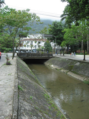
The avenue goes both sides of a canal getting the water of the tropical forest into the lagoon:
After R. General Garzon, you keep straight on R. Pacheco Leao, along the Botanic Garden (Jardim Botanico). If you see mountain bikers riding along this road, you are on the right way as the park is a favorite destination for cyclists!

Make sure to turn right at this sign:
And then get prepared for 3 miles of a good/steep uphill!
While I found several sites talking about trails in the Park (English, Portugese, Jungle Me guided tours) but couldn't spot them, I stayed on the road which, fortunately, had very few cars on, this Sunday morning.

After you enter the park (restrooms on the right),
you first pass a water fall
then reach the Vista Chinesa belvedere
from which you get an amazing view of the city (especially when it's not as cloudy as it was this weekend...), from Corcovado on the left:
to Barra de Tijuca on the right:
The road keeps going up for another kilometer or so, then goes down for 3 miles to the entrance at the other end of the Park.
A few more pictures in my Picasa album, including a few shots from my visit of the famous Sugar Loaf, unfortunately mostly in the cloud this Sunday...
One more reason I was happy to have woken up early and captured other views of the city from Tijuca, definitely a park to visit and run into if you happen to be in town!

Running in Rio de Janeiro, Brazil: Rodrigo de Freitas Lagoon

If you stay in Rio de Janeiro, chance is that you will pick a hotel near the famous beaches of Copacabana and Ipanema, in the South part of this large city (6 millions in the city and about 13.5 in the metropolitan area). Rio has been the capital of Brazil for 2 centuries but lost this status to Brasilia in 1960 when this new city was built in a more central location for this large country (5th largest area after Russia, Antarctica, Canada, United States and China).

Anyway, a few hours after landing, I went for a run, I didn't want to go too far before getting acquainted with the city (you hear so much about the bad reputation of "the favellas" but, meaning neighborhoods, there are favellas everywhere on the map and not all are bad fortunately!).

The taxi driver showed me the Rodrigo de Freitas Lagoon on our way to the hotel and that seemed like a great place to run. Here is a view of some of the many hills of Rio, and the lagoon, from Tijuca National Park (see my next post...):
At least I could see from the car a bike path on one side and was excited to find out if it went all around. Indeed, it does and for quite a distance, much more than what I expected. The distance is marked every 200 meters (1/8th of a mile) and, as I was running, I started to see the number going up, and up, and...
The whole lap is just short of 7,500 meters (4.6 miles). I did the first one at 6:31 min/mile, a pace I was able to maintain for 20 miles thanks to the excitement of catching up with some slower bikers and skaters!
On weekends the bike path gets very busy with many walkers, joggers, runners, bikers, rollerbladers, skaters, quadricyclists and it requires quite some attention to slalom between people going at very different speeds. The same skills required to drive in Brazil anyway! ;-)

When it's not too cloudy, there are great views of the statue of Christ the Redeemer at the top of the Corcovado mountain, as well as closer hills such as the Morro do Cantagalo, Morros dos Cabritos and the nearby National Park of Tijuca.
While I didn't spot any public restrooms, there are many booths selling fresh coconut juice which is one of the best natural electrolyte. These represent convenient aid stations to remain hydrated!
Overall, a great/perfect urban course for a flat and fast long run!

As an alternative, especially if you are staying in Copacabana, you can run along the beach, on the bike path. There is also a bike path along the beaches of Ipanema (below) and Leblon which get quite busy on weekends too.
And, if you can't make it to Rio this time, feel free to continue the virtual visit in my Picasa album!