


The flight of stairs to go up to the cabin was already worth a good workout!

As I mentioned in the introduction of my previous post, crime is a real thing in Guatemala. I wasn't sure what I could do on my own. A week in advance I tried to get tips on Facebook, from both US trail communities as well as local forums. I got confirmation about the crime situation, as well as the danger of dogs especially at dawn and dusk (I had some familiarity with that from my 6-day Coastal Challenge experience in Costa Rica in 2008).
I asked the very nice staff for advice and they indicated a technical trail to San Marcos, about 12 miles away. I left in that direction after watching France take two goals from Argentina in the World Cup Final, which didn't seem like a good start.

The trail along the lake was indeed convoluted but a nice and well maintained single track with magnificent views at every turn. A few lose dogs barking as I was approaching San Marcos but it was already 11 am, so they weren't too fierce, some good yelling did the job (at mid day, most dogs are just enjoying sleeping in the sun).


San Marcos was much closer than what the staff indicated, only 6 miles when I was passing by a small fruit shop with the TV on. To my surprise, the game was still on, playing overtime and... Argentina just scored 3-2 as I briefly stopped.

Thinking that I was just bad luck to France as Argentina scored 3 times while I was watching, I decided to explore further, in the direction of San Pedro, the city at the base of the huge volcano of the same name.


This time, there was no trail but a nice and wide road with moderate traffic, mostly tuk-tuks. The road stops at San Marcos and starts at Panajachel on the other side. And this is really a holly road as you can figure out by the names of the villages I crossed: after Santa Cruz (La Laguna), San Marcos (La Laguna...), Sam Pablo (La...), San Juan (La...) and San Pedro. Yes, you guessed right, La Laguna too. On the other side of the lake, the Scriptures continue with San Lucas Tolimán, San Antonio Palopó then Santa Catarina Palopó.


I had 10 miles on my GPS when I got to San Pedro.


I bought a bottle of water to refill, and a can of Coke, and asked the direction to climb the volcano. Heads-up for visitors: English isn't very useful in that area, better study Spanish! I found the trailhead on Google Maps instead and texted Agnes my intent to give it a try. 2 more miles of a steep road to the start provided a good indication of the slope ahead.

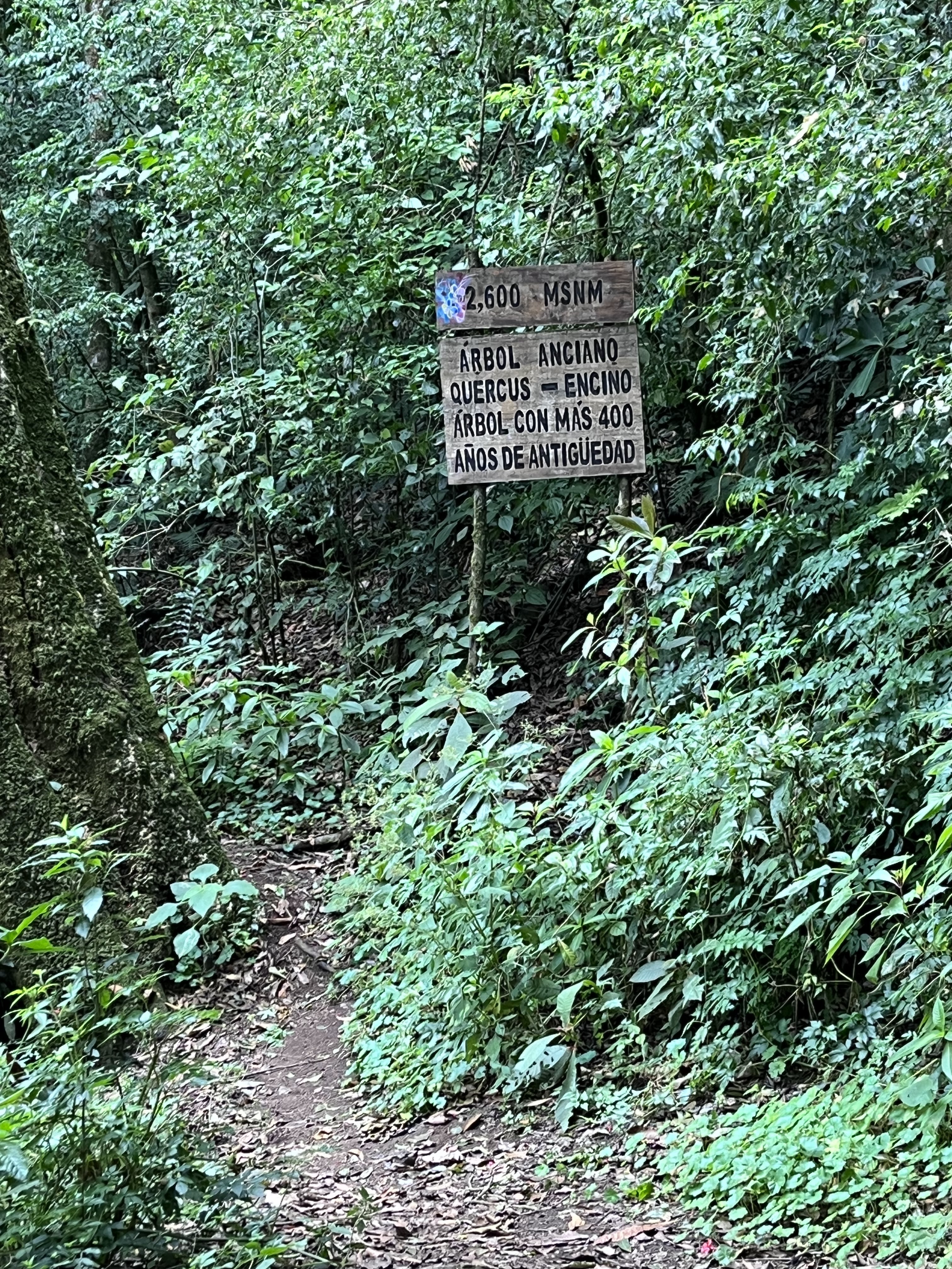
I didn't see any park ranger at the start and decided to proceed on the single track. I was pleasantly surprised of some trail marking but more importantly about wooden signs indicating each hundred meter of elevation gain. Surprisingly, they were precisely matching the elevation of my GPS (Garmin isn't known for the most accurate elevation data).


At the 2,300m shelter and lookout, I saw a park ranger with his 2 clients. It was passed 1:30 pm and I decided to forge ahead. Just before 2,400m, I crossed a woman hiking down and at the next turn, 2 policemen were waiting for me. They weren't speaking English but one of them used his phone to translate that I'd better turn down. They mention the weather which may change but, more importantly, that... bandits were at the top and they had done their patrol so I was on my own. I asked if the bandits were armed but didn't get an answer on that. I told them that I will turnaround before the summit then.
With the volcano culminating at 3,020 meters (9,910 feet), all the climb is in the rain forest, with trees blocking the view. After this last encounter, I have to admit this was one of the most stressful climb I did. Without the bandits, it would have been perfect otherwise: good footing with trail shoes (I didn't plan on actually climbing San Pedro initially so didn't pick my Leki poles) and numerous switchbacks. Instead of pushing, I climbed on my toes, trying to avoid breathing too hard and stepping on leaves and keeping scrutinizing the woods ahead and above me, both visually and with my ears wide open.
I stopped at every 100-meter of elevation gain to check on any noise or movement in these woods. 2,500, 2,600, 2,700, 2,800, my heart was beating faster...


Then I arrived into what looked like the perfect bandit den, an abandoned camp site with dark huts with open doors. And while I could see through the trees the cloud passing over the summit, the trail looked to be continuing first down, around the mountain.


Hmm, it felt so frustrating to be so close to the top, yet a good opportunity to turn around before losing my GPS, iPhone if not my life... While I was saving my valuables I would still say that the bandits succeeded in stealing that 3,000-meter summit from me...
I had studied the trail in details during my slow hike up, in case I was going to be chased by bandits, and was amazed at how many details, turns, roots, stairs, I had memorized. That made for a couple of faster miles, closer to 7 min/mile as opposed to 30 min/mile on the way up! In the short switchbacks, that was almost like skiing down, wedeln style, really cool! Not a great video, way too bouncy, but to illustrate the concept:
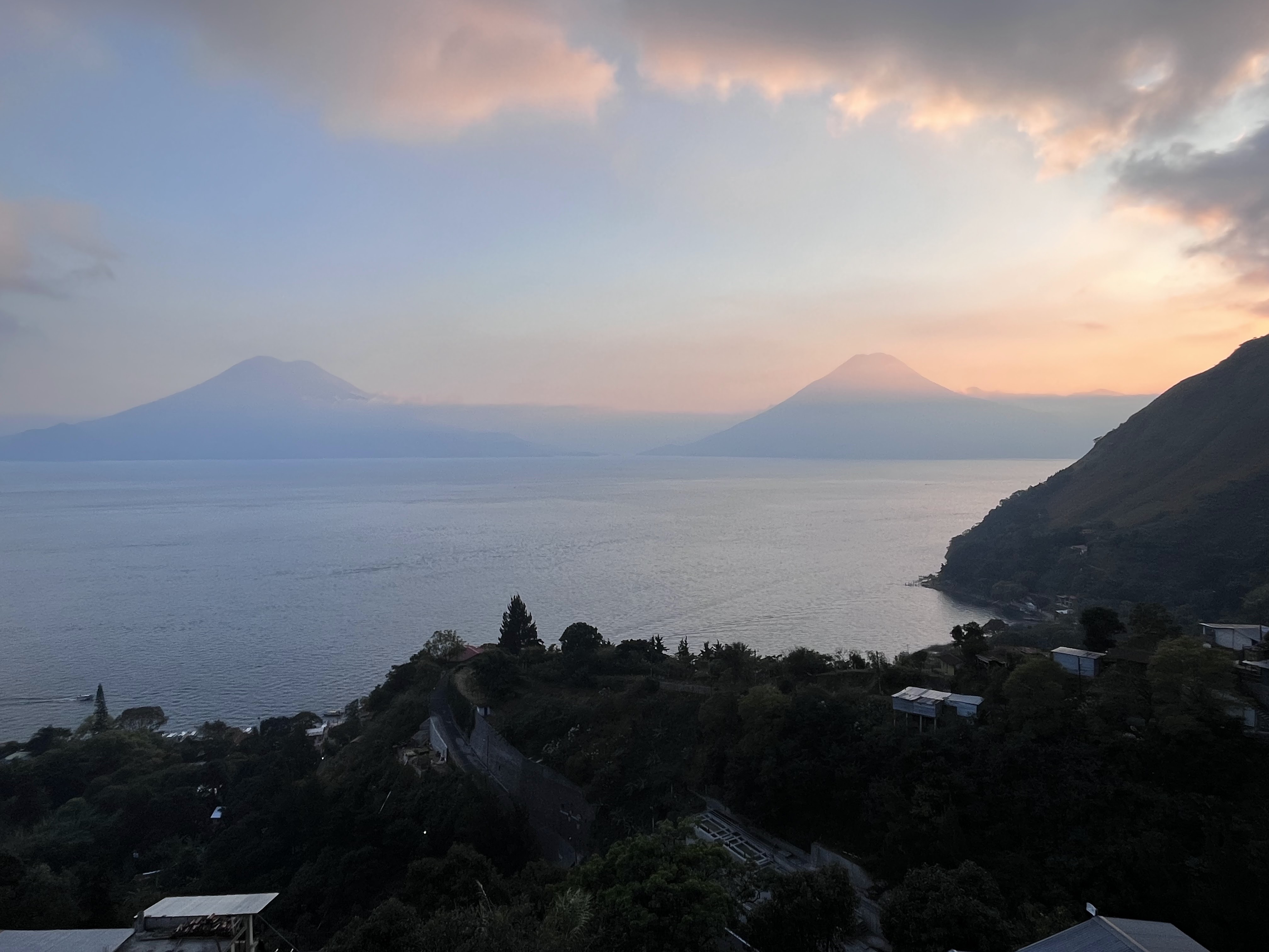
The view from the 2,300-meter rest area:
I was relieved to get back to the trailhead and main road and it was more than time to retrace my path back to the hotel. As the daylight was dimming fast around 5:30-5:45 pm, I grabbed a stick, just in case. Oh my, it became really handy while fighting a crazy dog for several long and stressful minutes. After escaping the bandits, I managed to avoid being bitten, but that was close. After this encounter, I picked a much bigger, longer and stronger stick on one hand, and my iPhone with it s light on to finish my run.
Phew, what a day! Even without a few missed sections on my GPS, still beyond the marathon mark, albeit at a very slow pace overall with all these adventures.
Someone had indicated to me a local ultra trail runner a few days earlier on one of the local forums but he only replied in Messenger while I was running. Short of more insights, I'm super glad this turned out into a positive experience. Although I'm split in recommending the San Pedro climb because of the associated crime risks. I certainly tried to find company by looking for local trail runners. I only regret to have started my run later morning, it would have been great to have the police patrolling at the top. Although I don't even know if they patrol every day, or it was just a one-time thing, or maybe on weekends. And, then, too early and you got the risk of being bitten by a dog... Anyway, my second back, safe and sound solo run in Guatemala, yeah!
To sum it up, here is the flyover video (click on the link or picture below):

And to situate San Pedro around the lake:

And on the country's map:

For those traveling to Guatemala, one note about transportation: while Panajachel is only 120 km (75 miles) of Guatemala City, it took us almost 4 hours by shared van. Google Maps gives a minimum of 2.5 hours without any traffic. Guide books strongly recommend tourists against using the picturesque and cheap Chicken Buses, those refurbished US school buses. There are plenty of small travel agencies everywhere to book these vans and, for our 3 trips, the pickup times have been quite reliable. As an indication, we paid 225 quetzals per person for Guatemala City to Panajachel, 150 for Panajachel to Antigua and 100 (versus the most common rate of 125) for Antigua to the airport (~14 miles). Plus tip to the driver (~10%). As for the lake, 25 quetzals for Panajachel to Santa Cruz, 10 for San Marcos to Santa Cruz.
Next stop: Antigua and its nearby massive Acatenango volcano!


1 comment:
This brought back a LOT of great memories of my times in Guate! On my first trip there in 1985 by motorcycle I rode there and it was magical.....I've heard the crime is rampant but generally off the beaten path and especially well policed in tourist areas so as to not scare off potential tourists and the vital revenue it generates ......Atitlan and the surrounding volcanoes and villages are magic....thanks Jean for posting such detailed writings, images and videos....glad to see you had a great time
Post a Comment