As I mentioned in my previous post about Mount Saint Helena, what do you find at the top of Mount Vaca? You bet, more communication relays and antennas! As a matter of fact, even civil and military ones for a change. So many that they are not accessible with a fire road this time, but a real asphalt one, even open to car traffic! That reminded me of Pikes Peak, the highest point of the Continental US which is accessible by car and train although it's above 4,000 meters! A fact which makes some people ask where the road is to get to the top of Mount Blanc, in Chamonix (I'm not kidding...)!
But, overall, and even more so than Mount Saint Helena, a climb to the top of Mount Vaca these days will plunge you back into the inferno of the 2020 Fall California wild fires, and it's overwhelming, on every side of the mountain and even hearing a few relays still powered by generators 7 months later as the power lines got severely damaged too.


In contrast with the burnt top, the start was actually super greenery and pleasant, home of fruit trees and growers.


On the way up, we saw a few ruins of houses burnt last year, heart breaking. Let's not burn bridges as we say (this house lost its creek crossing access), a good reminder in this divided society...
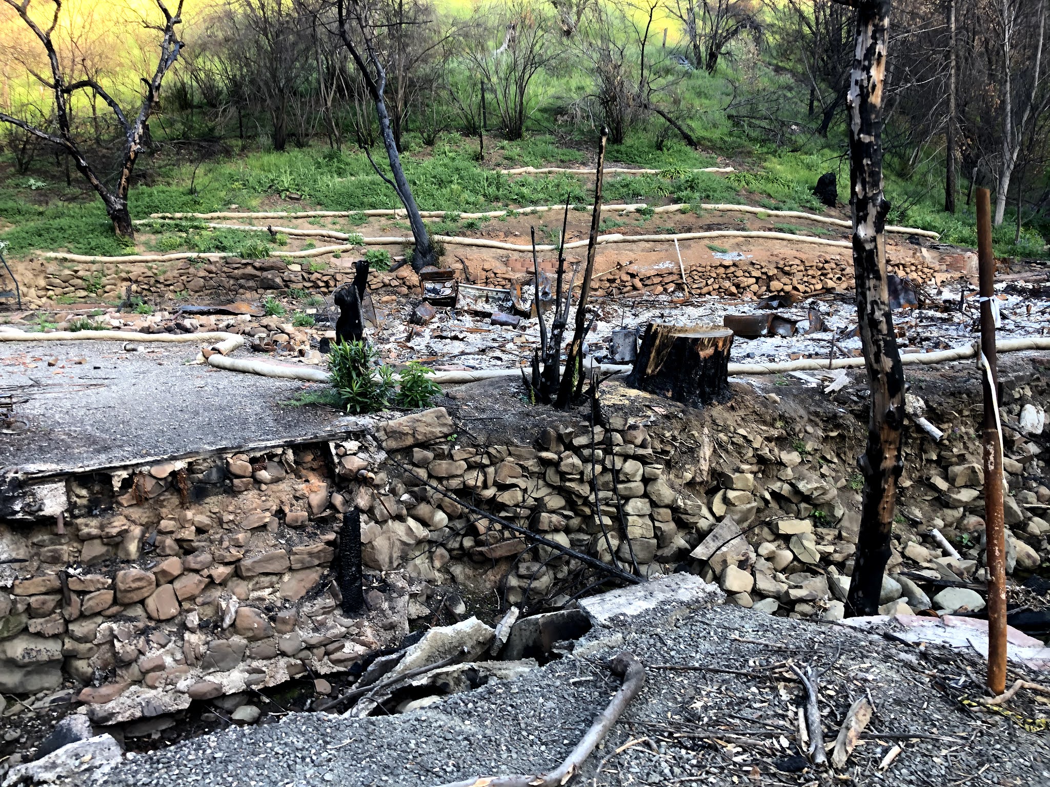


Even one burnt house at the bottom of the mountain, leaving a swimming pool dangling on the property, and showing the extent of the devastation in the area...

But we also noticed proofs of Mother Nature fighting back as well, more uplifting!


It's quite a steep road at times, must be a good challenge on wheels too!

At the top, you never really know if you actually reached the summit as this is more of a ridge with a collection of relays.


The one I preferred had fences down and this really cool mat which must be a launch pad for para gliders. A cool photo op spot!


The whole loop from the sky, thanks to Relive (click on link or picture below):

Et voilà, this concludes our 4-week challenge. Nothing really as challenging as the concept of peak bears, no peak covered with snow or ice, but an excellent opportunity to accomplish something as a family (but one, overseas) and discover new places, finally! For me, I had visited Mount Diablo once and Mission Peak many times, but not the other ones, at least not exactly their tops: Montara Mountain, Slacker Hill and Mounts Davidson, Umunhum, Tamalpais, Saint Helena and Vaca. I've heard PCTR is working on the next challenge, make sure to hop on the train in case you missed that one. And see you all out and up there then!


No comments:
Post a Comment