In our quest for a National Park a day, we had initially planned on stopping by the Craters of the Moon NP. We changed plans to visit good friends in Sandy, Utah, and we were delighted by this opportunity to visit a National Monument really off the beaten paths. We learned so much about the billions and millions of years which led us to where we are, we highly recommend the detour or trip up there. This park opened in 1990 but the visitor center is brand new and super modern (architecture inspired by Frank Lloyd Wright). Great exhibit showing a great variety of super detailed fossils. And we hiked to an archeologic site where we arrived as researcher just uncovered one of a fish, before our astounded eyes. (See pictures at the bottom of this post.)
We left Sandy around 9 am on Saturday (Independence Day) and, thanks to our ultimate time zone change, got to the 9th and last National thing of our road trip (thing meaning park, monument or recreation area). Because of the last minute decision and the lack of cell coverage in the car on such remote roads, we hadn't prepared our visit at all. Thankfully, this is a very simple park, there are just a handful of key highlights. While the caves must be something exceptional, it requires a reservation of a guide, so we skipped that. We drove the only road in the park, from the visitor center in Baker at 5,317 feet (1,621 m) up to the Wheeler Peak parking lot at ~10,200 feet (3,109 m)! Only in America do we have roads to these elevations, like Pikes Peak above 14K feet (4K meters)! No wonder why some tourists visiting Chamonix ask where the road is to the top of Mont Blanc... ;-)
Proud flag flying at the visitor center on Independence Day, with the peaks of the park in the background
Getting very high on the aerial road to the Wheeler Peak parking lot
The time to eat our picnic, it was 1:10 pm Agnès allotted me until 2:30 pm to hike the trail to the summit. That meant 1 hour and 20 minutes while the 8.6-mile round trip to the summit of Wheeler Peak is supposed to take between 4 to 8 hours per the sign posted at the trail head! With my ankle still swollen, I just wanted to see how high I could go...
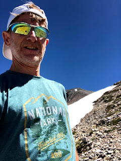
I started hiking but the trail was actually very nice and rather flat. After a mile of alternating power walking and running, I had gained only 100 feet of elevation, dang! By mile 2, 10,700 feet, slightly better. Then the trail became more technical, especially with loose rocks. I did average 14:35 min/mile for the first 2 miles but it took me 21:45 for the third mile. At that point I was really happy to reach a patch of snow and see 11,625 feet of elevation on my GPS (3,540 meters). I really wanted to keep going for the last 1.2 mile to the summit but it was more than time to turn back. Although 1.2 miles don't seem a lot, there were 1,400 feet left to climb and, worse, descend, in these tricky loose rocks.
I rushed back to the parking lot which I reached at 2:40 pm, close enough... Next time, I'll negotiate an earlier departure! ;-)
That's a really cool and accessible summit to climb, at almost 4,000 meters (just missing 18 meters!). Under this peak, there are nice trails circling Stella and Teresa Lakes. And several other trails in nearby canyons which we surely didn't have time to explore in such a ridiculously short visit (e.g. Lehman Creek, Snake Creek, Baker Creek/Lake, Timber Creek).
A 3D flyover of this short but Alpine 10K (click on this link, or the picture below):
If you can stay overnight, star gazing is supposed to be incredible given the park is literally in the middle of nowhere! As a matter of fact, it's on Highway which, on GPS maps, is tagged as "The loneliest road in America!" If you are driving there on your own, you are up for a good spiritual retreat, with so many miles at 70 miles per hour without saying any car. Better car pool then!
A few more pictures of that run/hike...
An easy flat and super pleasant first mile
The joy of finding and touching snow again this week!
Stella Lake from the Summit Trail
Loose rocks ahead, only the beginning at 11,000 feet!
Up to the peak from the right side
Back, almost on time...
10K-round trip to that tiny patch of snow!
The Wheeler Peak Summit Trailhead
Passing the Utah/Nevada border and getting on NV HWY 50, that Loneliest Road in America
Full moon rising in the desert
Watching the July 4th fireworks from ugly Fallon downtown
The full moon at night (although we missed the eclipse)
And now, a few pictures from our stop at Fossil Butte National Monument in Wyoming on Friday.
The super modern visitor center
A timeline of 4 billion years!
From the bottom of the lake, way back then, now corresponding to the white layers on the next picture
Picnic area, then a hike to the excavation demo at the top of the hill in the background
Yet another one!


No comments:
Post a Comment