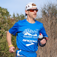
Gouville, Blainville, Coutainville, Tourville, Heugeville-sur-Sienne, Urville, Incleville, Regnéville, Hauteville, Annoville, Lingreville, Coudeville, Bréville, Donville-les-Bains, Granville, Jullouville, you got the pattern, Normandy is very rich of villages with name containing... "ville" (literally: city, town). I ran through all of these this weekend, and a few more! Being in Europe for a month, we had the opportunity to drive to Granville for the weekend, the land of my Mother's family where we spent most of my vacations when I was a kid, usually July, August and Christmas and/or New Year's Eve. Like in Paris this whole week where it rained every day, the weather was also bad, a lot of wind and quite some rain too. After our super dry Winter in California, way to celebrate the Summer season in Europe... ;-)
On Saturday I could squeeze a run 22-mile (35-kilometer) run in the morning before a family reunion. I ran along the sea toward the South, with the goal of seeing the Mont Saint Michel from the coast. The nearest point to do so coming from Granville on the GR is la Cabane Vauban, just after crossing the picturesque Vallée du Lude, after Carolles. Here is
a trace of my run on Garmin Connect (22 miles):
On Sunday, I wanted to run as much as possible of the same trail, the trail which goes around the entire Cotentin peninsula, but the Northern section that time. Agnès dropped me at Gouville-sur-Mer, North-West of Coutances. The wind was very strong but sideway fortunately, coming straight from the Ocean (West). GR stands for Grande Randonnée or more precisely for Chemin de Grande Randonnée. There are many more local trails throughout France but the GR as the longest ones, many continuous miles across or along a particular region. A national network similar to our highways. The GR 223 follows the long coast of Cotentin and is therefore called "Le Tour du Contentin." It is 430 kilometers long (267 miles). Here is
a page providing more details. In two days I ran 75 kilometers of the trail; with the 53 kilometers back in 2008 (my
Pilgrimage around St Michael's Mount), that is only 30% of the whole trail, there is opportunity for coming back, especially to run along the Nez de Jobourg, the North end of Contentin. You can download
the route from Garmin Connect (37.7 miles).
Overall the trail is a mix of asphalt levees along the major beaches, various types of trails in the woods (grassy or packed ground), many miles through swampy and grassy lots with hundreds of sheep, a few deep sand sections crossing dunes and a few sections which are hardly maintained.
The signage, red and white stripes, is quite good but you have to watch closely and potentially retrace your steps back to verify that you haven't missed a turn sign.
See
many more pictures (more than 150!) in my Picasa photo album.
Overall, a great way to run far from car traffic (most of the time), discover the Norman littoral in a way which is exclusive to pedestrians and alternate amazing views of the sea shore and country side. You just need to take into account that, with all the twists of the trail and varied running conditions, the route is much shorter for cars and on maps, and plan accordingly. Running, or walking for the matter, on a GR is not meant to be racing... ;-)
PS: this concludes another 100-mile week, or 355 miles so far in June. Some serious mileage before flying to Corsica for some hill training which should come handy in a few weeks in the Alps then Tahoe!


No comments:
Post a Comment